Activity 2: From the medieval town to the 19th century extensions

Brussels, capital of what?
Activity 2: From the medieval town to the 19th century extensions
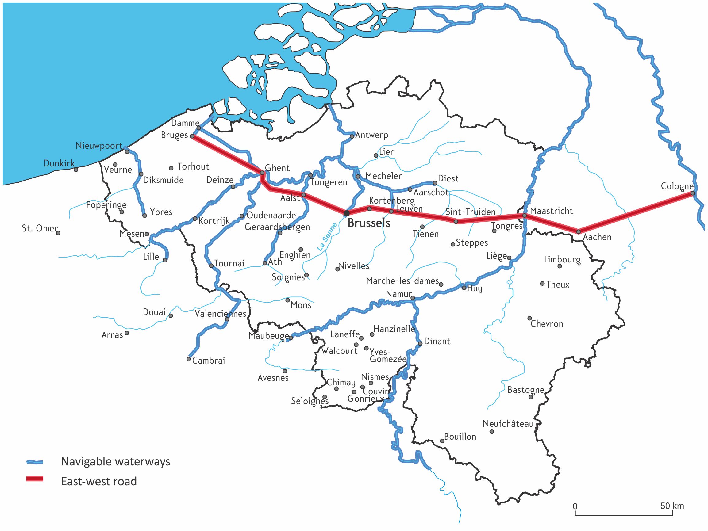 Navigable waterways and the major east-west land communication route in the Middle Ages, projected on a map of present-day Belgium.
Source: Royal Belgian Geographical Society (SRBG), from HAYT, Franz, 1988.
Altas d’histoire universelle et de Belgique. Wesmael.
From the 11th century onwards, several small settlements emerged along the banks of the Senne, a small river flowing from south to north. These hamlets gradually expanded and eventually merged to form Brussels. Their development is notably linked to the fact that the Senne was no longer navigable upstream (south) of Brussels. The goods had to therefore be (un)loaded there, with the rest of the journey being made on land.
As early as the 11th century, the places of political power (the ducal palace) and religious authority (the collegiate church), followed by the aristocratic quarters, established on the "mountain" at the top of the eastern bank of the Senne. At the same time, craft and commercial activities developed near the river, where the popular districts were concentrated (the lower part of the city). The wet plain to the west of the river was to be occupied later on. The first walls were built at the beginning of the 13th century to protect the political, religious and commercial core of the city, as well as the junction of the major traffic routes.
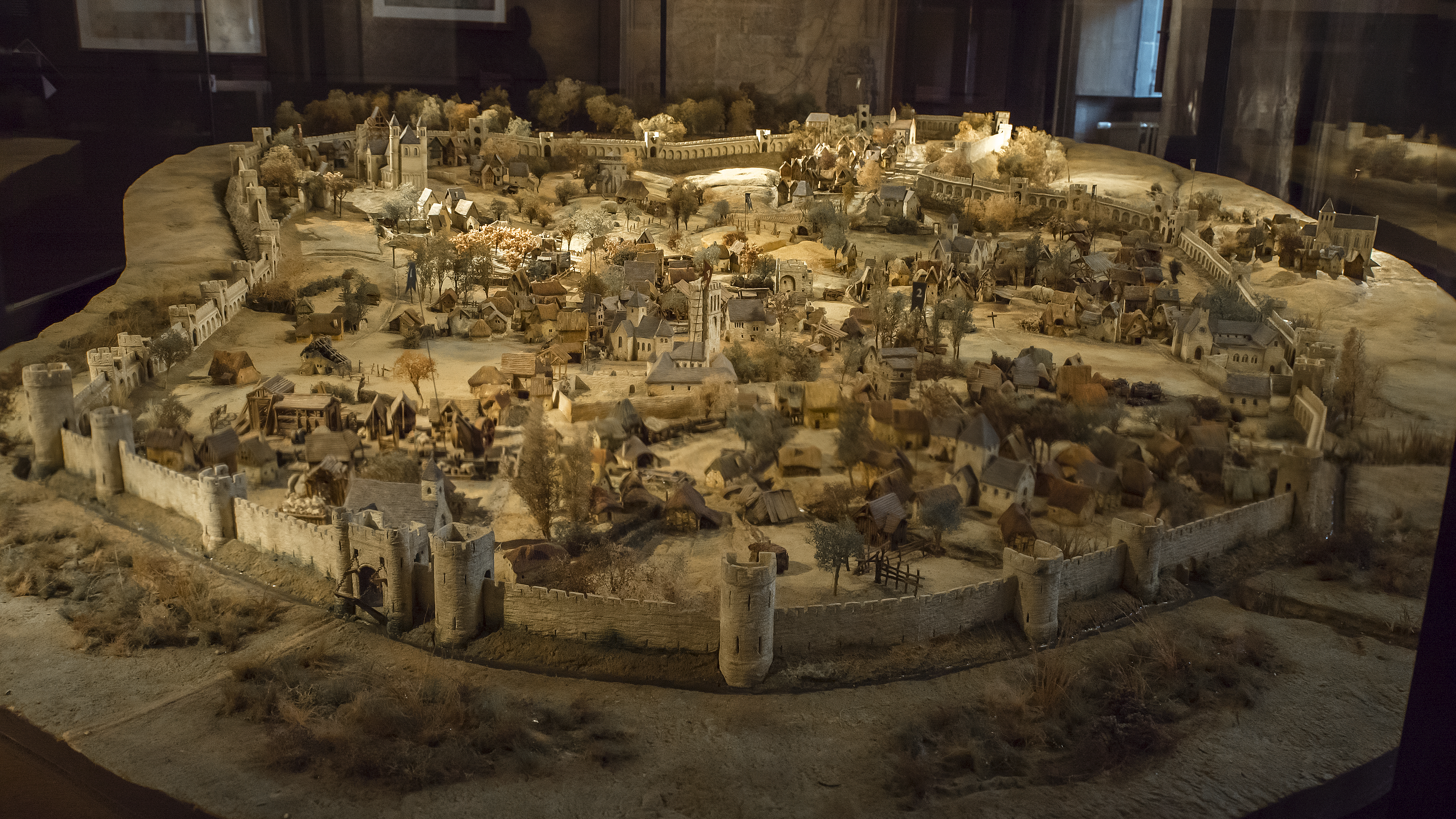
Model of 13th century Brussels surrounded by the first city wall - Brussels City Museum. The photo was taken from the west and thus looks up the slope from the valley. The large stone building on the right in the distance is the castle, which forms a protrusion of the enclosure. The collegiate church is in the back on the left. © Eyes-Screen/Brussels Studies Institute, 2019
Too narrow to protect a rapidly expanding city, the first wall was replaced at the end of the 14th century by the second city wall, which protected an area three times as large. It created the famous Pentagon, which is still clearly visible in the Brussels landscape.
Until 1860, one could only enter the city through one of the city wall gates, where the octroi was levied, a tax on imported goods. Following the abolition of the octroi in 1860, the rupture in the landscape between Brussels and its suburbs became blurred. However, it did not disappear entirely; despite the destruction of the city walls, the boulevards and car tunnels of the small ring road still mark the outline of the second city wall.
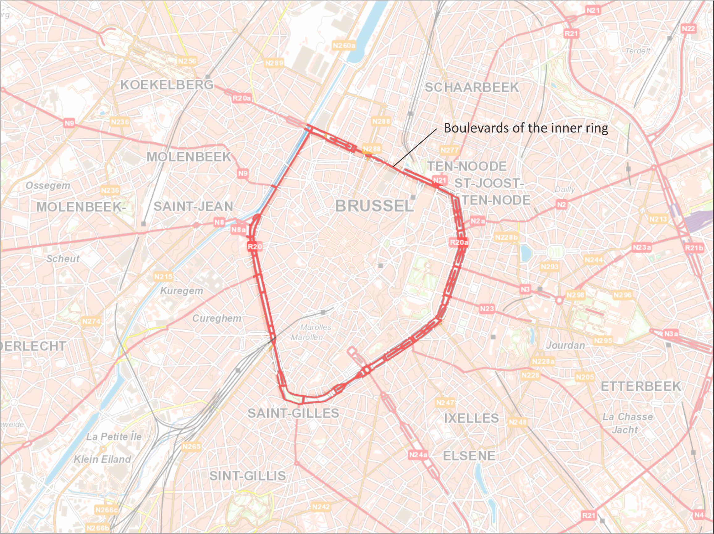 The Pentagon on a current map of Brussels. In red: the inner ring (road) of Brussels.
Source: background map, National Geographic Institute (Institut Géographique National - cartoweb.be)
When the second city wall was built, it encompassed vast areas of non-urbanised land, particularly in the western part of the Pentagon. In the course of time, urban growth led to the creation and extension of the first suburbs beyond the enclosure. Until Belgium's independence in 1830, these few outgrowths were situated at the city gates. Brussels gradually became cramped inside the Pentagon, but the destruction of the ramparts and the city's accession to the status of Belgium's capital did not change this, since it did not gain any new territory. The city would not increase in size until the mid-19th century. Between 1851 and 1913, the surface area of the City of Brussels more than doubled, from 415 to 1046 hectares.
The evolutionary map below shows the evolution of Brussels' urbanisation from the Middle Ages to the beginning of the 19th century. Slide the cursor to go forwards or backwards in time.
Do you have a suggestion, comment or remark about this activity? Click here!