
Activity 2 : Brussels, a biodiversity hotspot?

Bruxelles, Europe's greenest capital?
Activity 2 - Brussels, a biodiversity hotspot?
To start this chapter, let's explore some observations about the presence (or lack thereof) of biodiversity in Brussels. As we proceed, we will connect these observations with the history of Brussels, climate change, and social inequalities. It is important to examine aspects related to nature, the environment, biodiversity, air, and soil in the context of the neighborhoods' sociology, their history, and broader trends seen in Brussels and around the world.
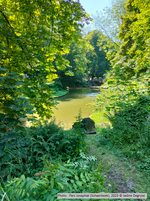
Photo: Josaphat Park (Schaerbeek), 2023 © Iadine Degryse
Let's start with THE question: is Brussels home to a great deal of biodiversity? To answer this question, we will first look at the green spaces and the soil. In the following activities, we'll be looking at water and air in Brussels.
Green spaces
Brussels has many different types of green spaces: forests, woods, parks, football pitches, cemeteries, private gardens (32% of green spaces in Brussels!), railway embankments, wasteland, large private estates, lawns, etc. Think about the spaces you sometimes visit and the different uses they are put to.
Would you like to discover the green spaces in Brussels? Take a look at the Brussels Gardens website developed by Brussels Environment, which lists all the green spaces in Brussels as well as a number of walks, with information on the facilities available to walkers, any opening times and the history of each space.
After this overview of the different functions, let's take a closer look at a remarkable green space: the Sonian Forest. Spanning Belgium's three Regions (check out Section 1 on the Regions in Belgium), the Sonian Forest covers more than 5,000 hectares, including around 1,660 hectares in the Brussels Region. This exceptional area is steeped in history, where the Dukes of Brabant and the aristocracy used to gather in the 13th century for hunting, often for game. Many of the streets in the municipalities to the east of Brussels are reminders of this past, as you can see on this map.
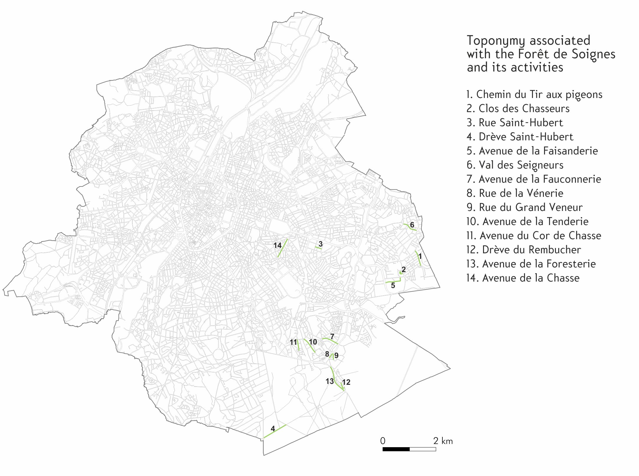
Cartography: Royal Belgian Cartographic Society, 2024
In order to maintain the best possible conditions for this activity, the forest was protected by various measures, including restrictions on logging and hunting by local residents. Hunting was reserved for the Dukes and Lords of the Sonian Forest. But the forest was also heavily exploited to supply the town and the State with timber, sometimes to an extent that threatened the regeneration of the trees. Successive authorities have regularly planted new trees. Some parts of the forest are therefore no longer very "natural", and sometimes resemble large tree monocultures. But the forest has undoubtedly retained some very ancient characteristics, particularly in its topography and the composition of its soils, which in certain places have never been exploited. If you want to find out more about the history of the Sonian Forest, don't hesitate to read this short document published by Brussels Environment: The Sonian Forest.
Today, the impact of the Sonian Forest on the Brussels indicators relating to green spaces is very significant. Here are a few figures to give you an idea of this impact. Can you make an instinctive guess as to where the values belong in the table? In the first column, place the values with the Sonian Forest, and in the second column, the values without the Sonian Forest.
As you can see, the Sonian Forest pulls all the indicators upwards, sometimes considerably. The claim that Brussels is a 'green city' is therefore mainly due to the footprint of this forest. However, this forest, which is open to the public, is located on the south-eastern outskirts of Brussels and is therefore not as easy to access for all the Region's inhabitants. Green spaces in Brussels are generally located on the outskirts of the city. The central districts (the Pentagon and the First Crown, see Section 1) have few green spaces, with the exception of the Parc de Bruxelles. Yet these are the most densely populated areas of Brussels. In the so-called "poor crescent" neighbourhoods, per capita incomes are also the lowest (remember Section 2). We'll come back to this a little later, but remember that Brussels is not a green city in the same way for all its inhabitants, as you can see from the various maps below:
Cartography: Royal Belgian Cartographic Society, 2024
You will notice that the sites in the European Natura 2000 network only represent a fraction of the sites with high biological value...
|
Reconnecting green spaces Most of the green spaces in Brussels are fragmented, including the Sonian Forest, which is criss-crossed by various roads. This situation leads to a high mortality rate among small animals such as frogs, toads, foxes, newts, pigeons, hedgehogs and martens. Large mammals are also affected by this fragmentation, which limits their movement and does not correspond to their familiar habitats. A number of projects, notably by the Flemish Region and Bruxelles Environnement, aim to reconnect green spaces by means of eco-bridges and animal tunnels. The development of a "green network" initiated by Bruxelles Environnement in 1996 consists of "creating green spaces where they are lacking and then linking all these spaces together in the most user-friendly way possible: introducing greenery along the city's access routes, lining boulevards with trees, improving pavements and cycle paths, taking advantage of waterways and their banks, railway lines, existing planted avenues, etc." (Bruxelles Environnement). Reconnecting green spaces also involves human beings: la Promenade verte ('the green walk') is one example. Its route circles the Brussels-Capital Region, linking different (semi-)natural areas so that pedestrians and cyclists are almost always on a safe, signposted route. Watch this short video to discover the Promenade verte itinerary:
|
Les sols
Soils
First, let's take a brief look at the quality of the soil in Brussels. You have just seen that 52% of the soil in Brussels is covered with vegetation, but not all of it has the same biodiversity (for example, there is a big difference between a football pitch and a wasteland). Soil polluted by various industries is also a major issue for the Region, which has been cleaning it up since 2005.
Caption of the interactive map below:
Soil condition
The soil status map includes all cadastral parcels for which Bruxelles Environnement has verified information on soil quality. Each plot of land recorded in the soil status inventory belongs to a category which takes into account the occurrence of suspected pollution as well as any soil pollution treatment studies and works carried out on this land. Please note: the soil status map evolves daily depending on the environmental permits issued, possible accidents and studies or soil treatment works carried out.
The categories are as follows:
Category 0: Potentially polluted plots
This land has not yet been studied: the soil may have been polluted. For example, if you are selling the land or no longer working on it, you should check whether the soil is really polluted by having a soil pollution assessment carried out by a soil pollution professional.
Category 1: unpolluted plots
The soil has been studied and complies with sanitation standards: the risks to human health and the environment are considered to be zero and all land uses are possible.
Category 2: lightly polluted plots without risk
Pollutant concentrations are very low, so the risks to human health and the environment are negligible. All uses are possible. But you can't reuse the soil from this plot on another site in Brussels.
Category 3: Polluted plots with no risk
The soil is polluted, but the risks are tolerable. You must comply with certain restrictions on use, for example: do not grow a vegetable garden or build a cellar, install a drinking water pipe or build a dwelling without managing the risks of pollution.
Category 4: polluted plots under study or treatment
The soil is polluted. Studies, remediation, treatment or monitoring of decontamination measures are underway. If you are selling such a property, you must have a soil survey that has been declared compliant. The person buying or selling the land must also undertake to carry out the rest of the treatment obligations laid down by Brussels Environment and must have set up a financial guarantee to do so.
[Source: Brussels Environment, online]
If we look at land use, there are sometimes tensions between protecting biodiversity and building projects. Wasteland, land that has been (temporarily) abandoned and that is sometimes mistaken for land covered in weeds, is often a place of great biodiversity for both flora (plants, trees) and fauna (insects, birds, small mammals). In activity 5, we'll be looking at the social action taken to conserve and protect these areas.
To complete this first activity, take a close look at this map showing all the current place names in the Brussels-Capital Region that have an environmental connection:
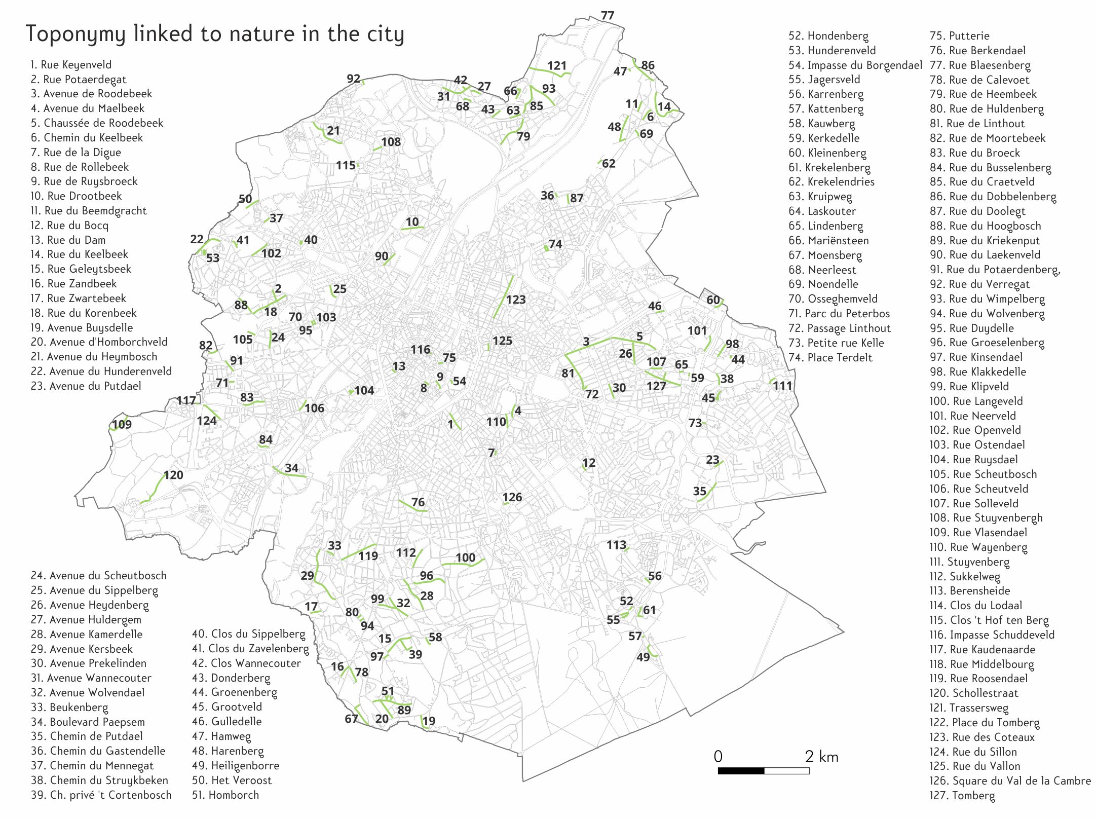
Cartography: Royal Belgian Cartographic Society, 2024
Do you have a suggestion, comment, remark about this activity? Click here!

