Activity 2: Grand Place, the commercial heart of the city

Brussels, a permanent construction site?
Activity 2: Grand Place, the commercial heart of the city
From the market place...
The map below (which you have already seen in section 1) is a reminder of how Brussels developed from the Middle Ages onwards, at the intersection of trade roads and waterways.
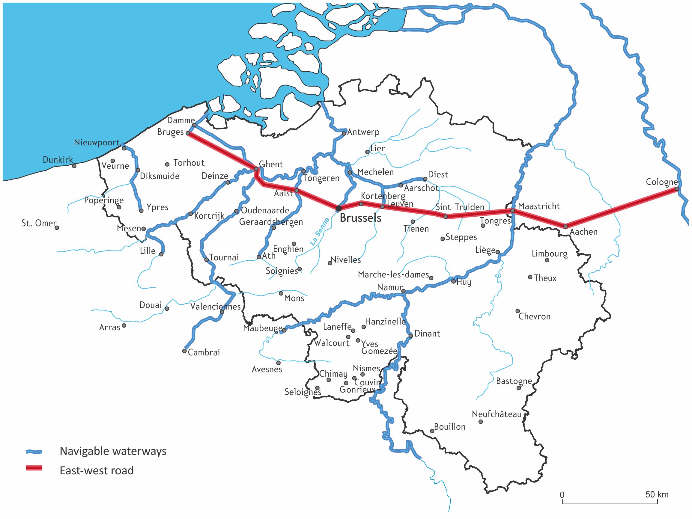
Navigable waterways and the major east-west land communication route in the Middle Ages, projected on a map of present-day Belgium. Source: Royal Belgian Geographical Society (Société Royale Belge de Géographie), from HAYT, Franz, 1988. Atlas d’histoire universelle et de Belgique. Wesmael.
Let's zoom in a bit! In order to give you a better understanding of how the major east-west road (the "Steenweg") has marked the city, we've drawn it for you on a current map of Brussels. You can see that it enters the Pentagon via the Namur Gate and exits at the Flanders Gate, having passed through the heart of the city where it once crossed the Senne, allowing goods to be loaded and unloaded.
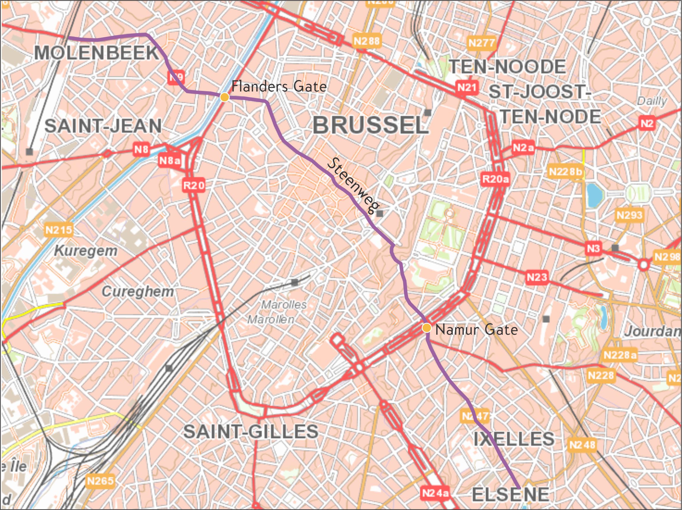
The outline of the "Steenweg" in Brussels' current centre. It was a medieval east-west trade route linking the Namur Gate to the Flanders Gate. Today, the names of the metro stations ("Porte de Namur / Naamsepoort" and "Comte de Flandre / Graaf van Vlaanderen") bear witness to the former entrances to the city. Source: Base map of the National Geographic Institute (cartoweb).
The following topographical map is a reminder of what you have seen in section 1, namely that the river Senne, which is very entrenched upstream, used to open out into a wide plain in Brussels, where it meandered and caused frequent flooding. The contour lines clearly show this strong asymmetry, which heavily influenced the development of the city. The places of power (Coudenberg Palace, St Michael and St Gudula Cathedral, etc.) and most of the attractive districts (the current "upper town") were located at the top of the steep eastern slope. Conversely, the gentler slope of the western bank saw the establishment of a series of craft and, later, industrial activities. It was hence this part of the city that was chosen for the digging of the canal linking Brussels to Willebroeck (and thus to the Scheldt and the North Sea) in 1561, followed by its extension in 1832 to Charleroi (linking Brussels to the industrial area of Hainaut).
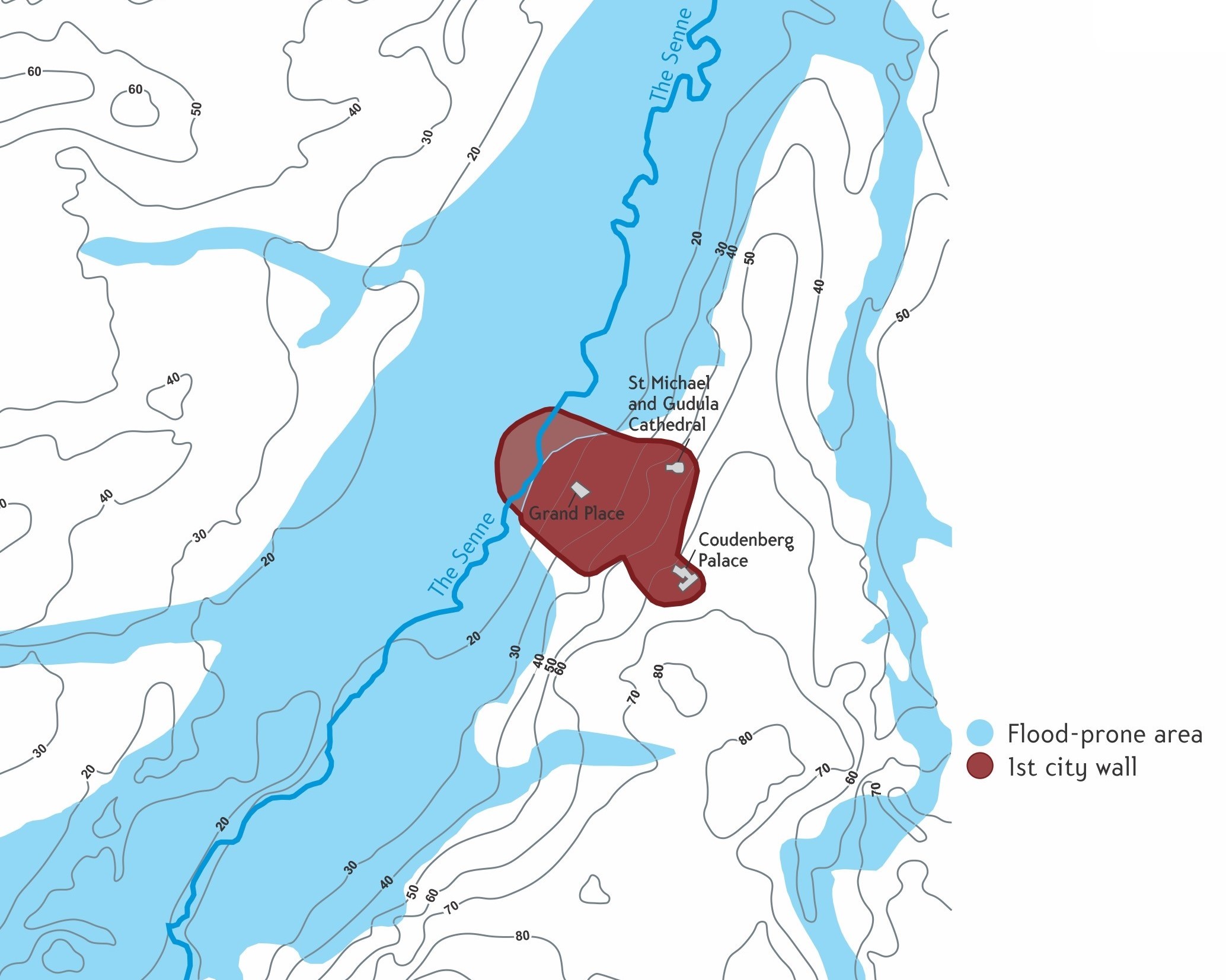
Map showing the contour lines of the Senne valley and the first enclosure of Brussels. Source: IGEAT.
The location of Brussels certainly favoured its commercial development. As such, the 12th century saw the establishment of an open-air market, which would become the economic heart of the city and the future Grand Place. This is the place that most people discovering the city visit first, in order to see first-hand what Victor Hugo called "the most beautiful square in the world".
As you walk around the immediate vicinity of the Grand Place, you will probably notice some street names that recall the medieval trading function of this part of the city. (Re)discover these streets with their evocative names and immerse yourself in the historical heart of Brussels' magnificent Grand Place.
... to the centre of power
At the beginning of the 15th century, the decision was made to transform the alderman's house into a new town hall to accommodate a growing administration. The town hall was completed in the mid-15th century and was soon surrounded by the houses of various guilds, marking their desire to emphasise the power of their professions and take part in governing the city. The Grand Place hereby took on its definitive shape. After this, it was only modified by the gradual replacement of wooden houses by stone and brick buildings throughout the 16th and 17th centuries, and then by its reconstruction after the city's bombardment by the French army in 1695.
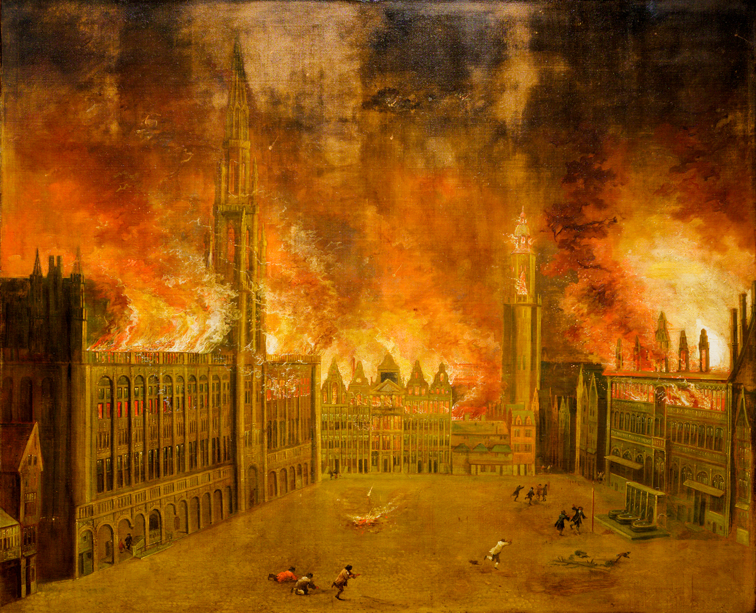
The fire of the Grand Place in 1695, author unknown, Brussels City Museum. © Trougnouf (Benoit Brummer). Public domain.
After this bombardment, which destroyed a number of the buildings surrounding the Grand Place, the speed of reconstruction was remarkable. The previous buildings were promptly rebuilt on their foundations, without fundamentally altering the urban structure. The guild houses that line the Grand Place are a fine example of this. By 1697, most of them had already been rebuilt on the same sites, without any attempt at creating symmetry. They illustrated the wealth of the guilds: the powerful professional associations that were involved in city management. Their facades were gilded and polychrome, rivalling one another with sculpted figures, symbols and garlands, ornamentally crowned with vases, scrolled pediments and domes. These constructions testify to the desire of the master merchants and craftsmen to outdo each other. Moreover, the baroque architectural style, which was coming to an end elsewhere, was used here with all its ardour.
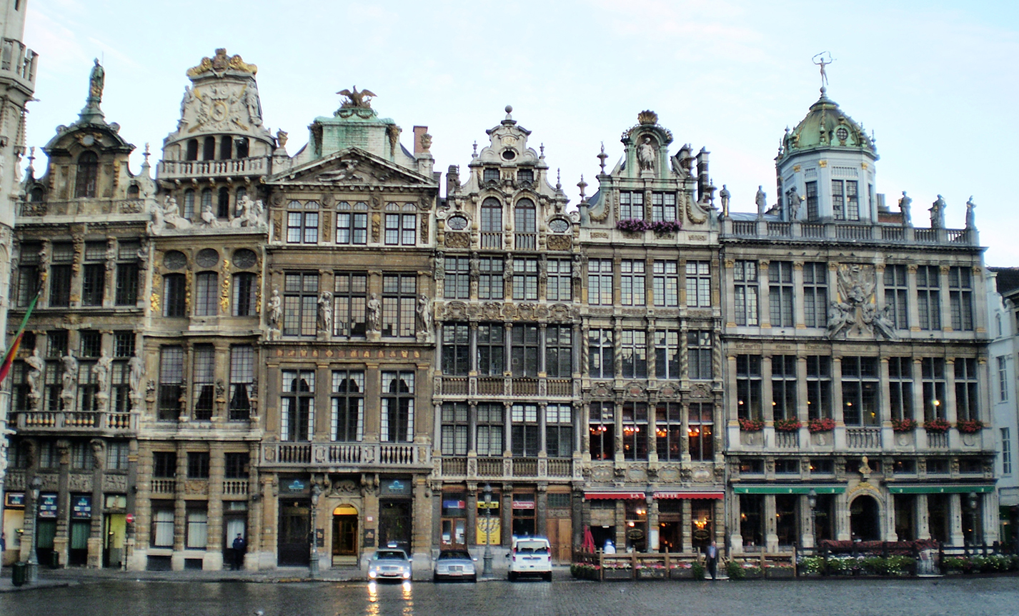
Several guild houses of Brussels' Grand Place. © Ben2, CC BY-SA 3.0.
That being said, the Grand Place also shows that other aesthetic values gradually gained ground: those of balance and symmetry. This is exemplified by the building previously known as House of the Dukes of Brabant, where seven different houses are grouped under the same pediment.
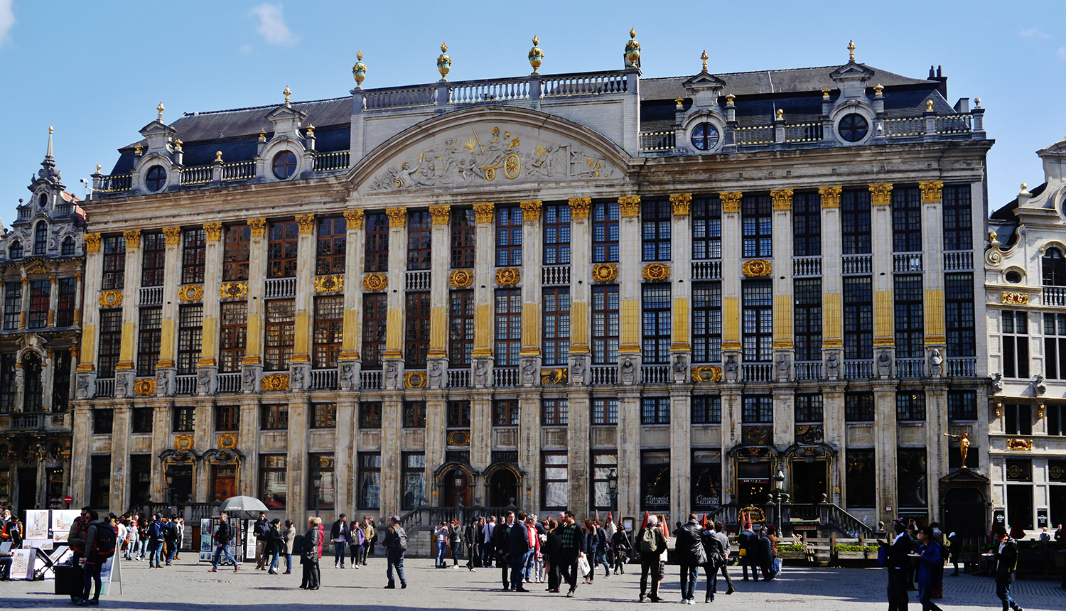
House of the Dukes of Brabant at Grand Place, Brussels. © Zairon, CC BY-SA 4.0.
With this interactive photo, you can learn a little more about the buildings that line the Grand Place and which attest to the economic and political importance of this site.
Do you have a suggestion, comment or remark about this activity? Click here!