Activity 3: The great modern construction projects of the 19th and 20th centuries

Brussels, a permanent construction site?
Activity 3: The great modern construction projects of the 19th and 20th centuries
With its narrow, winding streets and dense urban fabric, Brussels long retained the character of a medieval city. However, from the 19th century onwards, urban densification, the development of new services, and the desire of local and national elites to portray a dynamic, prestigious and modern capital, led to profound changes in the urban landscape. This desire to "enhance" the city so that it would better meet the standards of the time was at the root of a whole series of major building projects that changed the face of the capital. These enormous works, often imposed without any real consultation with the inhabitants and largely benefiting property developers, led to significant population displacements and the destruction of part of Brussels' heritage.
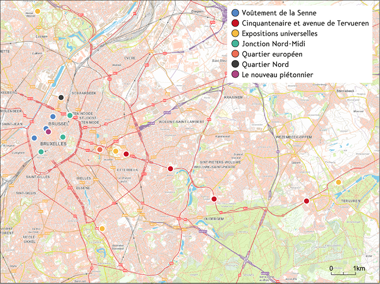
Map of the major construction works in Brussels. Source: base map of the National Geographic Institute (cartoweb).
The covering of the Senne
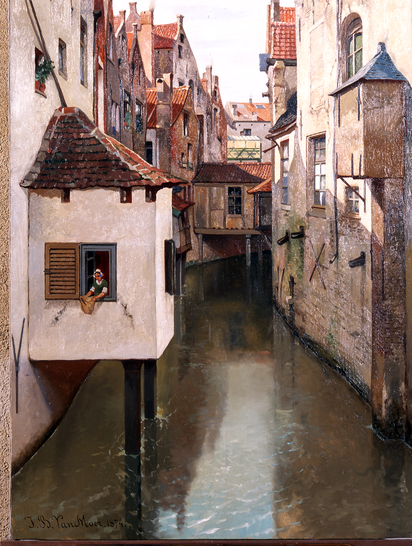
View of the Senne near the street known as "Plattesteen", by Jean-Baptiste Van Moer (1874). This painter produced a series of paintings to preserve the memory of the houses of old Brussels that were destroyed for the vaulting of the river (© Brussels City Museum).
The increasing industrialisation of Brussels, the growth of its population and the desire to appear as a great modern capital led to a policy of renovating the historic districts and adapting the thoroughfares.
The first major project symbolising this policy was the vaulting of the Senne, which was carried out from 1866 to 1871 under the direction of Mayor Jules Anspach.
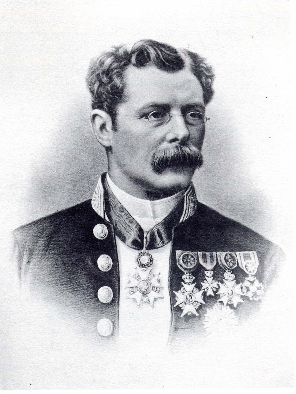
Jules Anspach (1829-1879), Mayor of the City of Brussels. © Lithography in Jules Garsou's book, public domain.
The Senne had gradually become an open sewer, which was all the more problematic due to regular flooding. In 1865, Mayor Jules Anspach enacted a beautification and sanitation plan for Brussels, of which the vaulting of the river was one of the principal features. A large boulevard was built on top of the Senne, forming a new traffic axis between the North and South stations. This axis was framed by prestigious new buildings (including the Brussels Stock Exchange, inaugurated in 1872) and immediately providing new visual perspectives.
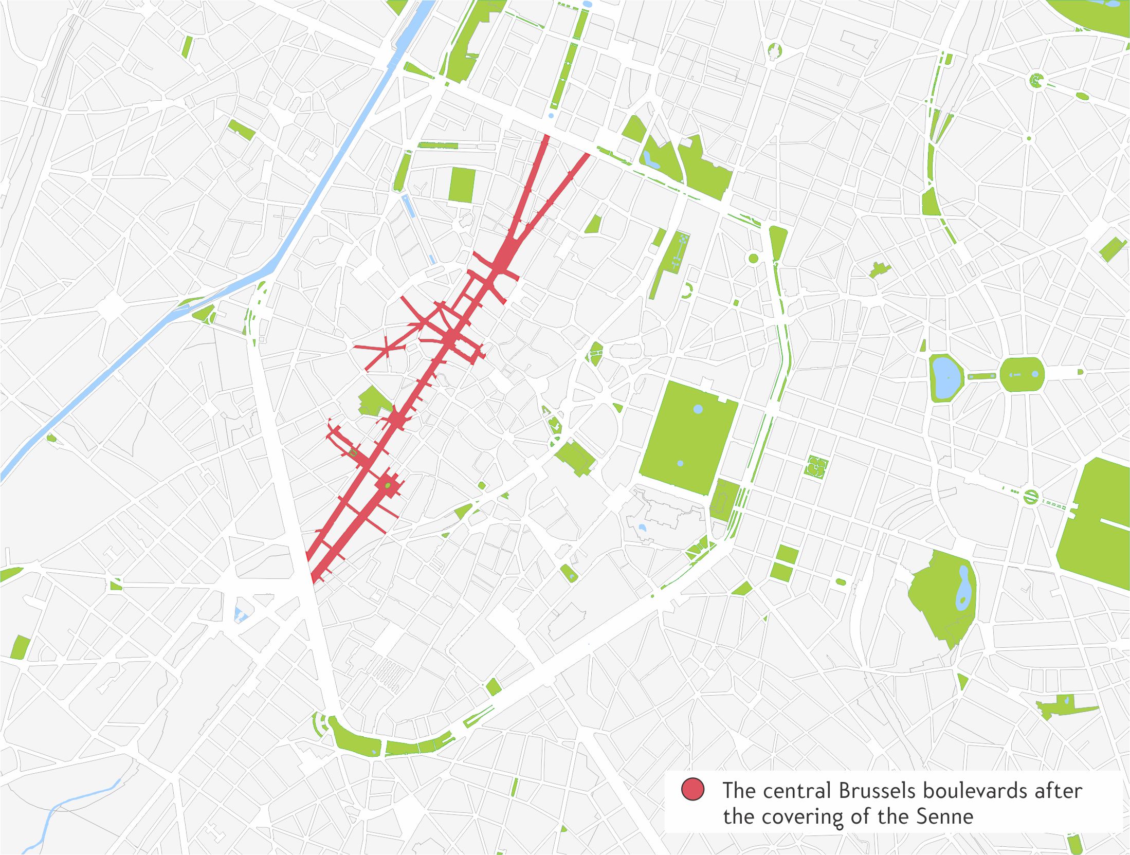
The central Brussels boulevards after the covering of the Senne. Source: Base map, UrbiS.
These huge works drastically changed the city. Several old neighbourhoods disappeared, with thousands of houses and many small industrial buildings near the river being razed to the ground. They also reinforced the division of the city, with the more affluent neighbourhoods to the east, the boulevards with shops and prestigious buildings in the centre, and the working-class districts to the west.
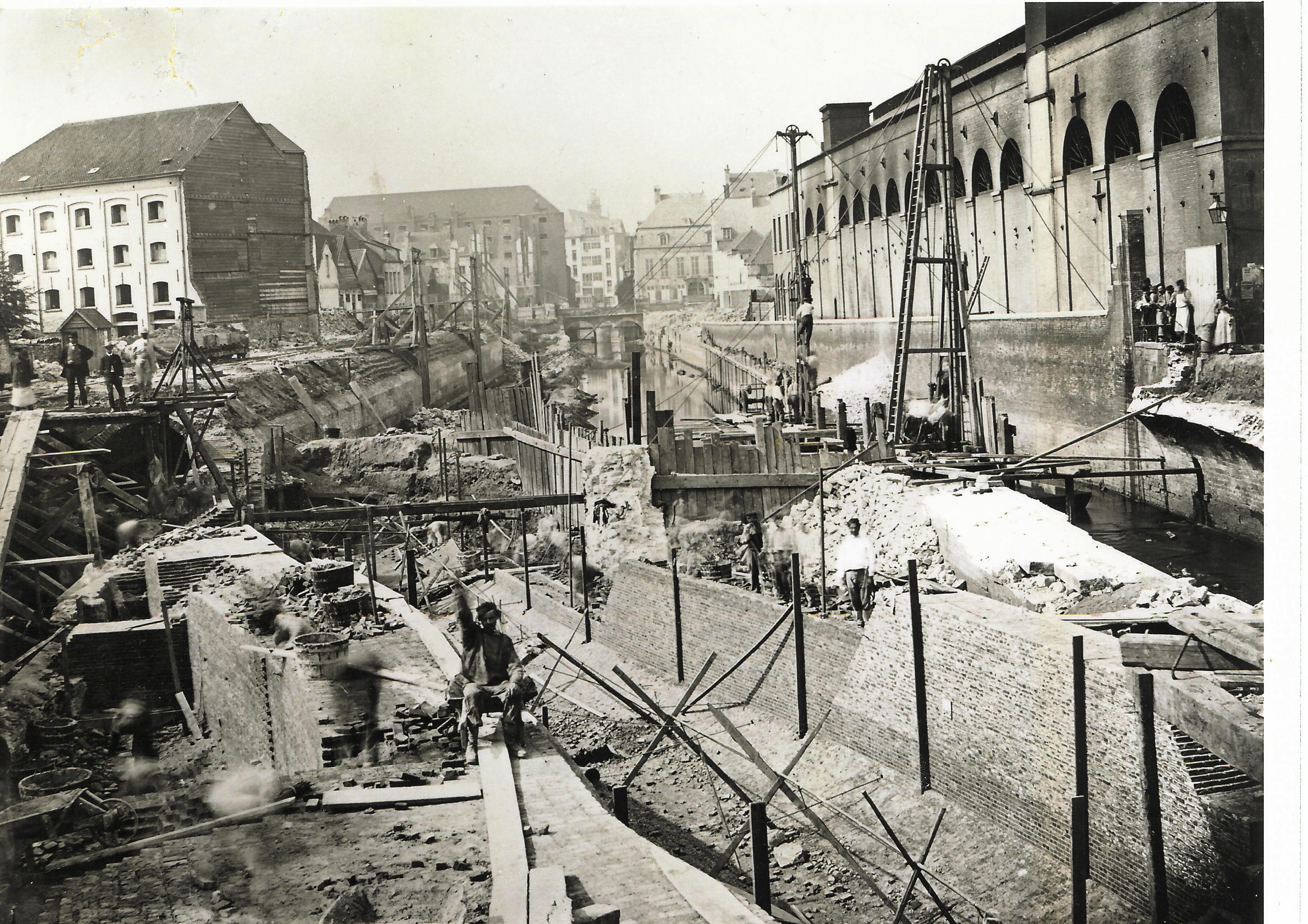
The construction site for the covering of the Senne at Boulevard d'Anvers / Antwerpselaan. Source: City of Brussels archives, C 11459. © Collection Guides Badeaux.
The urban planning policy of Leopold II
Concerned about the image of his small kingdom's capital, King Leopold II wanted to ensure a coherent and planned urban development of Brussels. He thus used his institutional power to have his civil engineer, Victor Besme, draw up a new plan for the city, which included the creation of a second ring of major boulevards around the Pentagon. Ultimately, these only ended up being realised in the eastern part of the city.
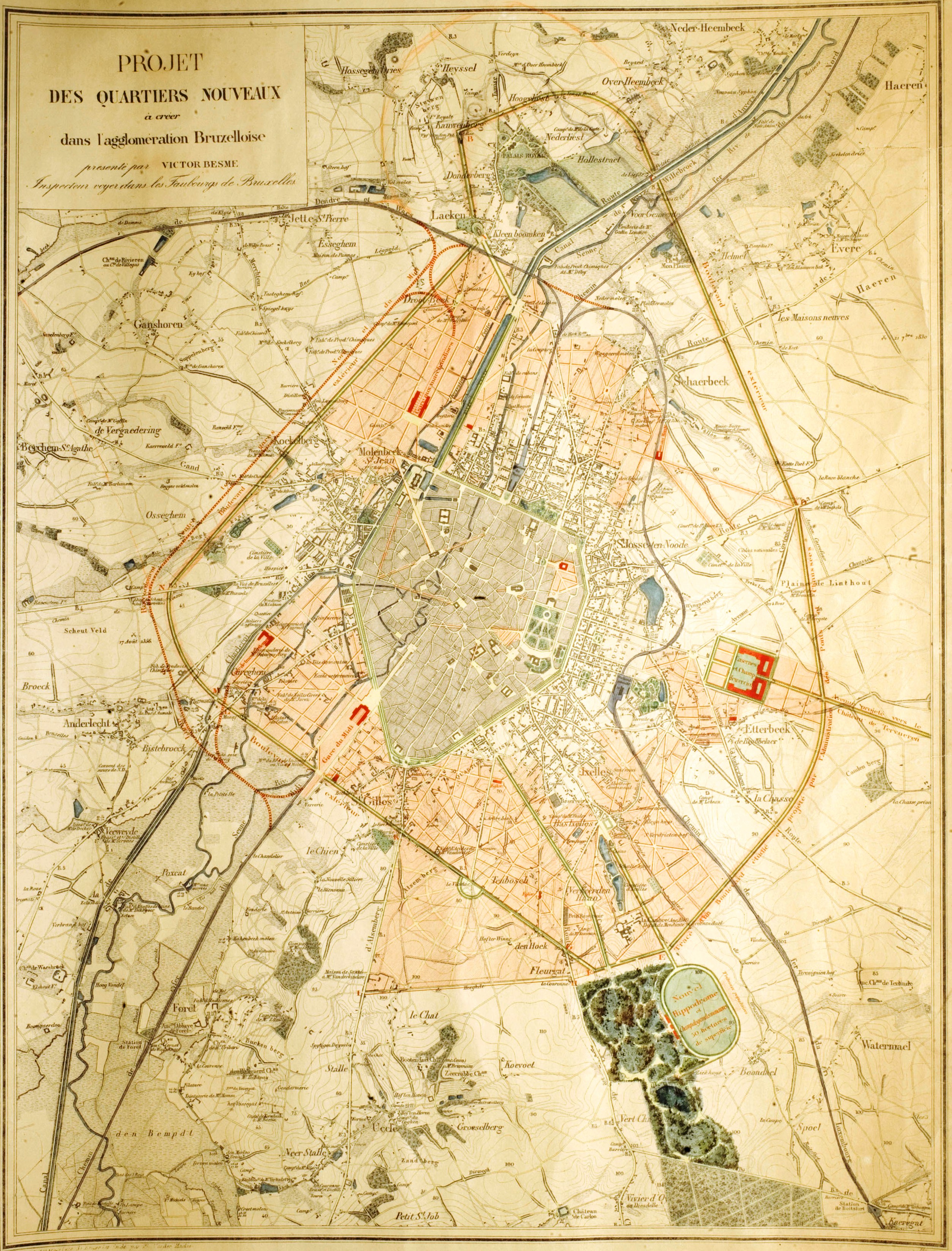
General plan for the extension and enhancement of the Brussels conurbation by Victor Besme, civil engineer (1866). Source: City of Brussels archives, plans of Brussels, n°96/8 © Collection Guides Badeaux.
Leopold II also used the enormous profits from the exploitation of Congo to pursue a very active land-use policy, allowing him to establish several parks (such as Forest Park and Jardin du Roi / Koningstuin). He also had the Palace of Tervuren rebuilt and laid out the prestigious avenue linking it to the Cinquantenaire.
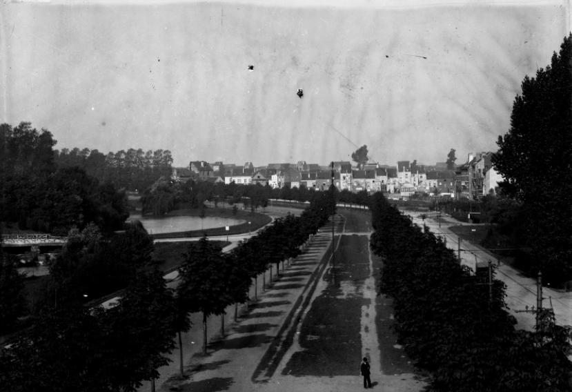
Avenue de Tervueren / Tervurenlaan in 1908 © Régie des Bâtiments / Regie der Gebouwen; Ministère des Travaux Public / Ministerie van Openbare Werken.
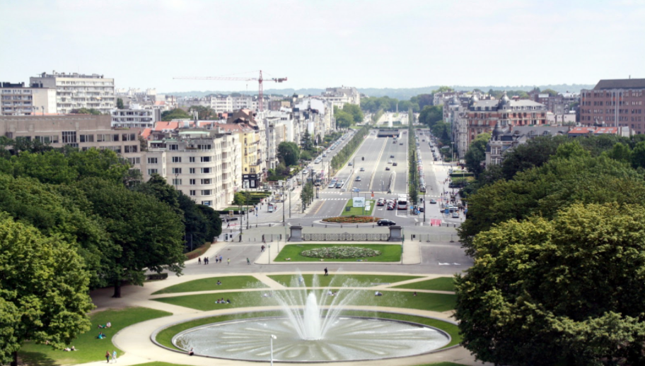
Avenue de Tervueren / Tervurenlaan today. © Roman Szuszkiewicz, CC BY-SA 3.0.
International Expositions
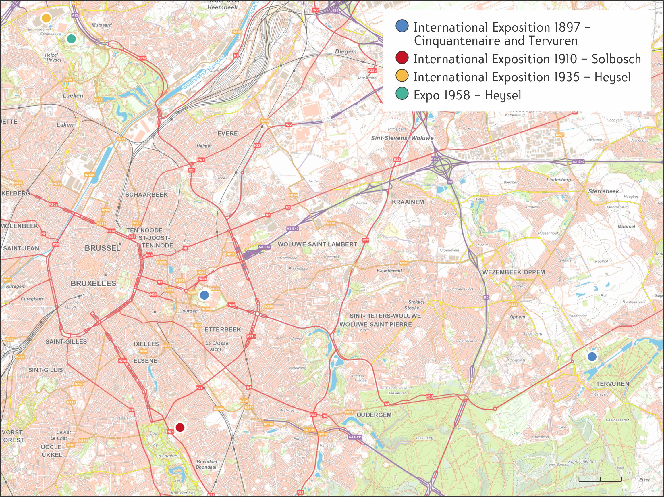
Map showing the locations of the various World's Fairs of Brussels. Source: Base map of the National Geographic Institute (cartoweb)
From 1888 to 1958, Brussels hosted five international expositions, all of which left their mark on the urban landscape. The first two (1888, 1897) were instrumental in the development of the Cinquantenaire and then the Avenue de Tervueren / Tervurenlaan. The third (1910) contributed to the urbanisation of the Solbosch district, which, after the First World War, became the site of Université libre de Bruxelles (ULB). The last two (1935 and 1958) formed part of the urbanisation of the northwestern area of the capital.
Sites and transformations related to the international expositions of Brussels
These exhibitions also brought about major construction works in the capital to facilitate their access (such as the construction of the inner ring road tunnels and a viaduct for Expo 58).
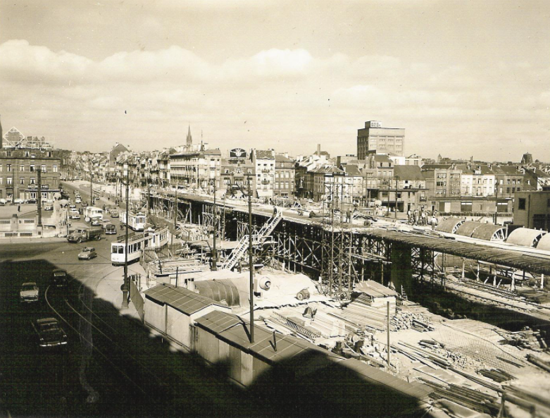
The construction of the Leopold II viaduct at Place de l'Yser / Yserplein, in preparation for the 1958 Brussels World’s Fair. © Collection Guides Badeaux.
The North-South connection (1902-1952)
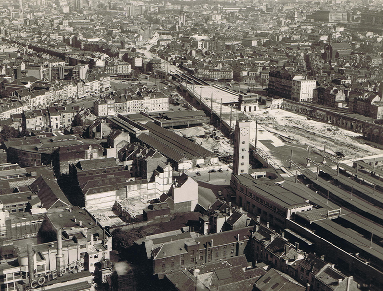
The construction site of the North-South connection at Boulevard du Midi / Zuidlaan. © Collection Guides Badeaux.
The North-South connection is the longest lasting construction project in the history of the city (1902-1952). With a length of 3.8 km, it linked two previous terminals (North and South) via a viaduct and tunnel, also resulting in the construction of a central station in the heart of the city. This project's realisation disfigured a chunk of Old Brussels through the destruction of several historical neighbourhoods. 17 hectares of very dense housing were razed to the ground and thousands of inhabitants had to be relocated. Since there was no coherent reconstruction plan, enormous soulless boulevards were built over the connection, lined with typical 1950s office buildings. Despite the lack of attention to its urban planning impact, the construction of this connection, which became a main axis for Belgian rail traffic, was presented as a technical feat that demonstrated the know-how of Belgian engineers.
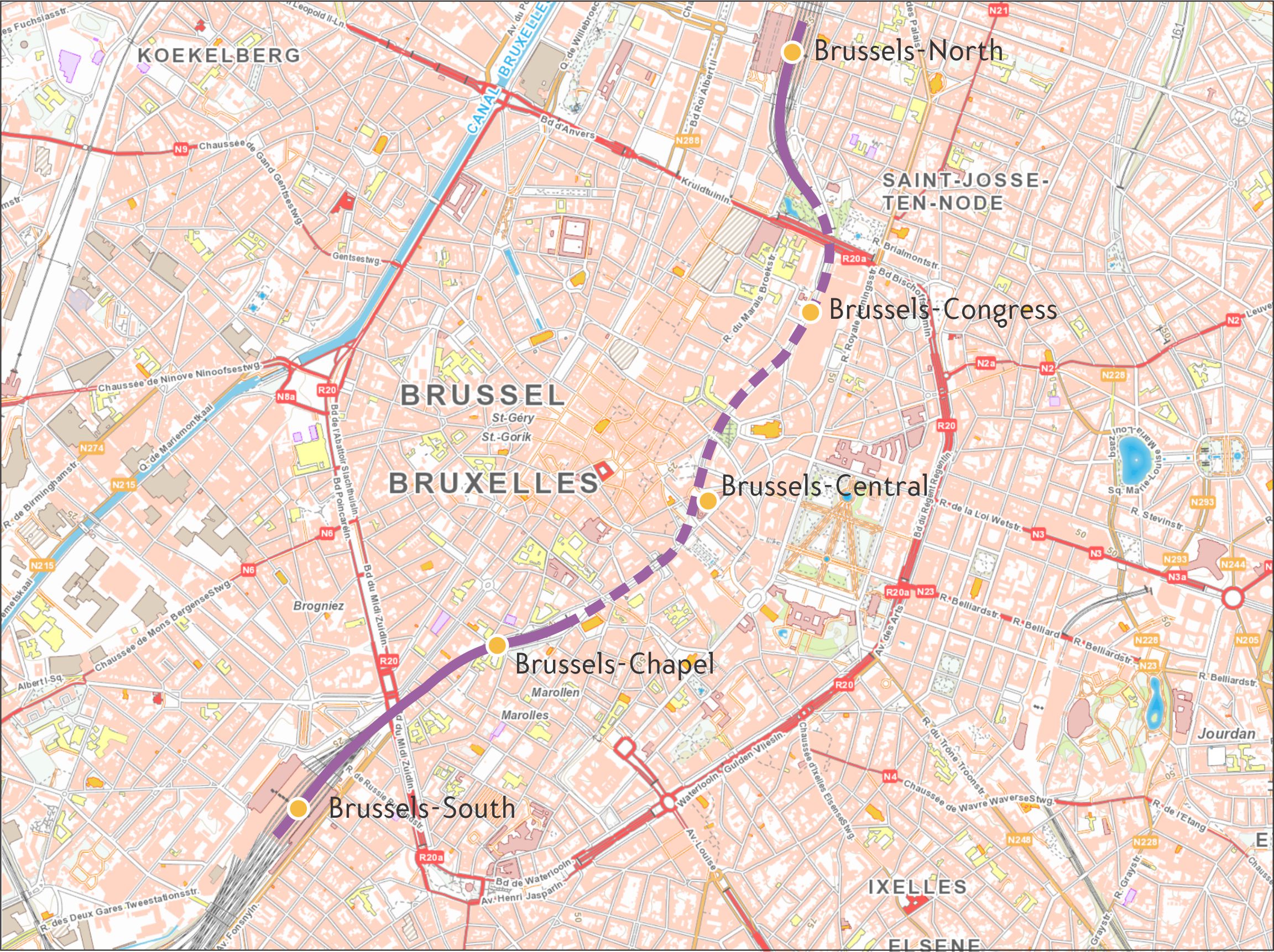
The North-South connection, to the east of the main boulevards, strengthened the north-south axes of the capital. The dotted line represents the railway tunnel. Source: base map of the National Geographic Institute (cartoweb).
The construction of the European Quarter (1957)
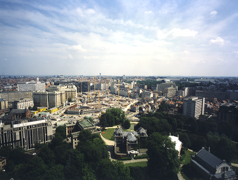
The construction of the Justus Lipsius building, whose foundation stone was laid in 1989 and which now serves as the headquarters of the Council of the European Union in Brussels. © Photography Anny Haut-Paul Nemerlin - Collection CIVA, Brussels.
The Leopold Quarter, annexed to the municipality of Brussels in 1853, was for many years home to numerous mansions of the Brussels aristocracy. After the First World War, a number of them were replaced by offices. However, the major turning point came in the 1950s when Brussels was chosen as one of the seats of the European institutions (see section 1: Brussels, capital of what?). This resulted in a large proportion of inhabitants leaving the Leopold Quarter, turning it into a district of office buildings. These then proliferated over the following decades to meet the needs of the various European institutions. Hence, the old Leopold Quarter and the area around the Schuman roundabout have been profoundly transformed over the past few decades, forming what is today known as the "European Quarter".
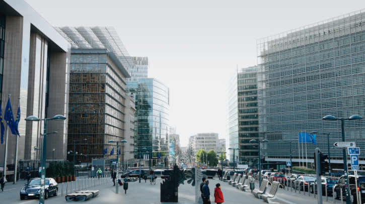
The present European Quarter at Rue de la Loi / Wetstraat. © Eyes-Screen/Brussels Studies Institute, 2019.
Do you have a suggestion, comment or remark about this activity? Click here!